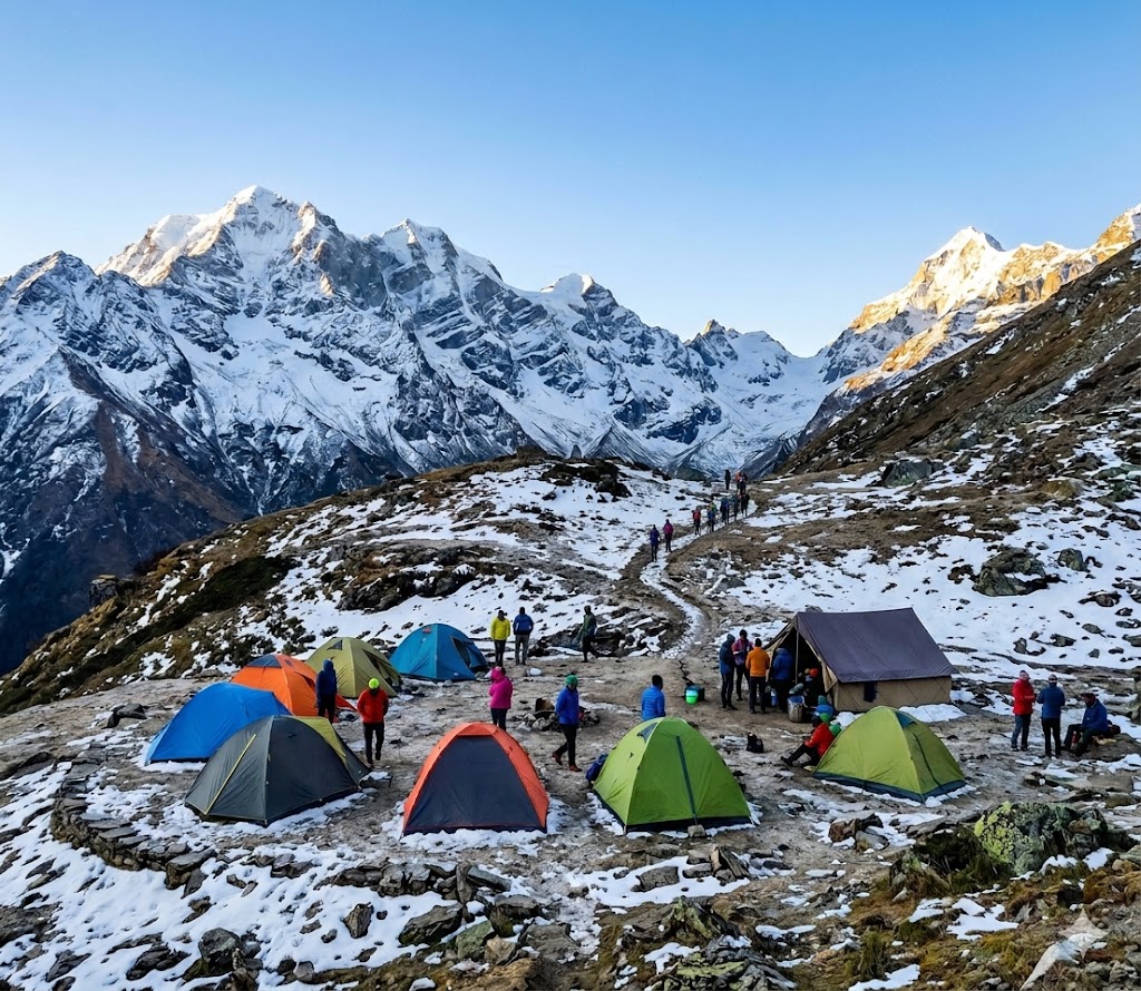
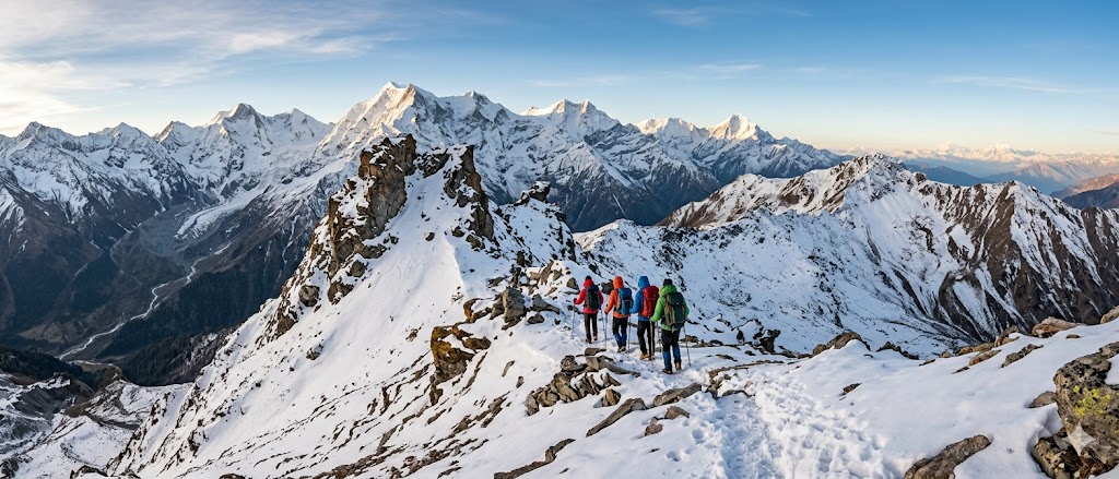
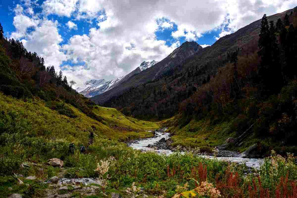
The Bali Pass Trek is one of the most exciting and challenging high-altitude treks in Uttarakhand, connecting the beautiful Har Ki Dun Valley with the sacred Yamunotri region. Standing at an impressive altitude of approximately 4,950 meters (16,240 feet), Bali Pass offers a perfect blend of adventure, breathtaking mountain views, alpine meadows, ancient villages, and glacier crossings.
This trek takes adventurers through some of the most scenic landscapes in the Garhwal Himalayas, including lush forests, remote Himalayan villages, sparkling rivers, vast meadows, and snow-covered mountain passes. The dramatic views of Swargarohini, Bandarpoonch, Black Peak (Kalanag), and Ruinsara Range make Bali Pass one of the most rewarding trekking experiences in India.
Ideal for experienced trekkers seeking a challenging Himalayan expedition, the Bali Pass Trek promises unforgettable memories and stunning scenery at every step.
Overview
Bali Pass Trek is a challenging and scenic Himalayan trek located in the Garhwal region of Uttarakhand. The trail begins from the Sankri side and gradually passes through Taluka, Seema / Osla, Ruinsara Valley, and the high-altitude Bali Pass before descending towards Yamunotri. This trek is known for its raw wilderness, steep climbs, snow patches, ridge walks, and panoramic views of the Himalayas.
This 8-day Bali Pass itinerary is designed for trekkers who want a real adventure beyond regular beginner treks. The route offers a perfect combination of forests, rivers, meadows, alpine lakes, remote campsites, and high mountain pass crossing. Due to its altitude and demanding terrain, Bali Pass is recommended for physically fit trekkers with prior trekking experience.
Highlights
- High-Altitude Himalayan Adventure: Cross Bali Pass at approximately 4,950 metres (16,240 feet) and experience the thrill of a challenging Himalayan trek.
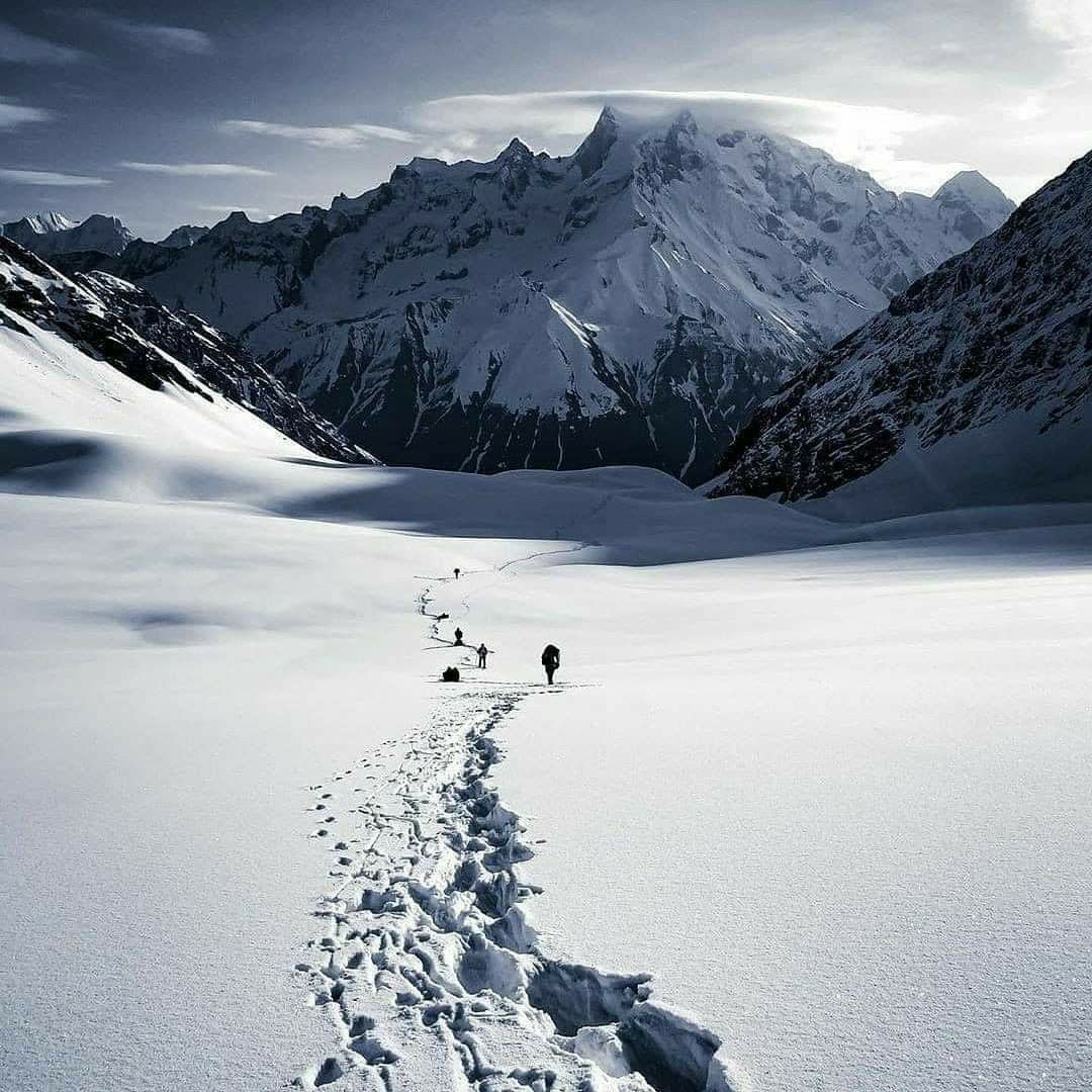
- Stunning Himalayan Views: Enjoy spectacular views of Swargarohini, Bandarpoonch, and other majestic peaks of the Garhwal Himalayas, weather permitting.
- Explore Har Ki Dun Valley: Discover beautiful landscapes, lush meadows, and traditional mountain villages along the route.
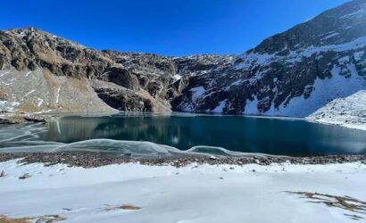
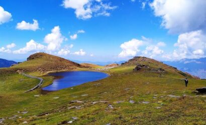
- Scenic Ruinsara Tal: Visit the picturesque alpine lake of Ruinsara Tal, surrounded by dramatic mountain scenery.
- Remote Mountain Trails: Walk through dense forests, alpine meadows, rocky paths, and rugged high-altitude terrain.
- Panoramic Bali Pass Summit: Experience breathtaking mountain views from one of Uttarakhand's spectacular high mountain passes.
- Beautiful Campsites: Enjoy camping beneath the Himalayan sky at designated campsites along the trekking route.
- Rich Himalayan Landscapes: Witness changing scenery, from green valleys and forests to snow-covered slopes and rocky mountain passes.
- Challenging Trekking Experience: Test your endurance on steep ascents, descents, and demanding high-altitude trails.
- Unforgettable Adventure with Touch Himalayas: Plan your Bali Pass Trek with Touch Himalayas and explore the extraordinary beauty of Uttarakhand's mountains.
Itinerary
Drive Distance: 200 Km (9 -10 hrs) via Mussoorie and Purola
Altitude Gain: 4,920 ft.
Meals: Evening snacks and dinner
Stay: At Touch Himalayas guesthouse
On the first day, the drive is approximately 200 km away from Dehradun to Sankri, which will take roughly 10 hours to arrive at its destination. At around 6:30 A.M., the drive begins at the base of the valley at an elevation of 1,480 ft, and ends at the base camp at an elevation of 6,400 ft. The route will take you along the banks of both the Yamuna and Tons rivers, through dense pine tree forests, and past a number of small mountain villages. The length of this drive is an important factor in assisting your body to acclimatise at this altitude. Once you have reached Sankri, you are welcomed with evening snacks and dinner at our beautiful Touch Himalayas' own guesthouse.
The journey consists of a 200 km trek through the mountains, which serves as a natural bridge between two parts of India. To start from Dehradun, one must ascend quickly up the steep switchbacks of the Mussoorie mountain range before descending into the Yamuna valley on the way to crossing over into the Tons valley at Naugaon. This transition from wide, broad highways to narrow, steeply mountainous roads takes place gradually and will begin to show signs of ruggedness the closer one gets to the Govind Wildlife Sanctuary; therefore, the road will follow a cliff that has been cut by the fast-running turquoise waters of the Tons River.
On the first night of your trek, you will be staying either at a homestay that has been built of wood (traditional) or possibly in a guest house that has been converted into a homestay and will give you a home-away-from-home feel; this will provide a warm place to stay during the cool nighttime temperatures. Another important factor to keep in mind is that Sankri is considered to be the last town where you will be able to get most logistics from; the mobile networks typically have poor reception after you leave the Purola region, and electricity outages are common in the area; therefore, it is important to have all batteries charged (including for your camera) before arriving in Sankri.
Drive Distance: 16 Km (1.5 hrs)
Altitude Gain: 1,600 ft
Trek Distance: 4 Km (3 - 4 hrs)
Altitude Gain: 500 ft.
Meal: Breakfast, packed lunch, evening snacks & dinner
Stay: At Seema campsite
You'll start with a short 16 km drive from Sankri to the lovely village of Dharkot. This drive will take about 1.5 hours. At Dharkot, you will begin your trek with a 4 km to reach the Seema campsite. There will only be approximately 500 ft of elevation gain during this trek. Since you will be taking 3 to 4 hours to reach this destination, it will be a relaxing (or "active recovery") day of trekking after spending the previous night in Sankri. After reaching the riverside camp at an elevation of 8,500 ft, you will have some snacks and a hot meal while enjoying the wonderful view of the Himalayas as the sun sets.
When you begin your drive in the morning, your drive will follow a rugged mountain road carved into the cliffside of the Supin Valley. Once on foot, you will be travelling on a wide, well-marked trail along the left bank of the Supin River. But with gradual inclines, much of the trail will be through ancient forest clearings. Today will be a bridge day, i.e., a transition from the civilization of Sankri into the deeper wilderness of Govind National Park.
The Seema camp is a large flat grass meadow located right next to the river. Unlike the guesthouses in Sankri, you will sleep in high-quality dome-style tents. The facilities here will be basic but comfortable, with a separate dining tent. Since this is a camp beside a river, the temperature will drop a lot after the sun goes down, so have your warm layers available.
Trek Distance: 10 Km (6 - 7 hrs)
Altitude Gain: 1,650 ft.
Meal: Breakfast, packed lunch, snacks & dinner
Stay: At Rainbasera campsite
Today begins with a 10-kilometer trek through the wilderness. The journey to the Rainbasera campsite takes about 6 to 7 hours and includes about 1,650 feet of elevation gain (10,150 feet above sea level). You will start your morning with a filling breakfast at Seema, after which your trek leader will take you out on a beautiful trail that mixes equal parts consistent trekking with scenic. Enjoy lunch on the trail throughout the day and arrive at camp just in time to enjoy snacks in the evening.
The terrain today will begin to get classically rugged as you have left the large flat valley. The trail follows the Ruinsara River, which is one of the main tributaries of the Supin River, around the river's bend and out. You will be trekking on a combination of narrow forest foot trails, rocky parts, and will need to cross small stream beds by way of small wooden bridges. The path has a lot of ups and downs at a very slow rate, and as you navigate around very large rocks and roots that are throughout the forest, you will have to maintain a steady pace while making these ascents and descents.
Rainbasera is a wildly beautiful campsite set in the wilderness. It is a truly wild camping experience - listening to the sounds of both river and waterfall will make for an excellent soundtrack to your evening's rest. All of the logistics will be handled by the Trekup India crew, and you will camp on somewhat uneven ground which adds to the rugged nature of trekking to Bali Pass.
Trek Distance: 7 Km (4 - 5 hrs)
Altitude Gain: 1,650 ft.
Meals: Breakfast, lunch, snacks & dinner
Stay: At Ruinsara Tal campsite
Today’s trek consists of about 7 km (4–5 hours) of beautiful scenery with a gain in elevation of 1,650 ft to reach the holy Ruinsara Tal lake by lunchtime. The reason for arriving early is to allow for an afternoon of Active Acclimatization (resting your muscles and allowing your lungs to adjust to an elevation of 11,800 ft. above sea level).
The trail rises continuously along the Ruinsara River, ascending a narrow valley until it opens up to reveal the Ruinsara Tal. As you get higher in the valley, the forest canopy will change from higher Pine trees to lower-height Birch and Rhododendron bushes. The trekking terrain will consist of classic glacial valley terrain (boulder hopping, muddy/slippery areas, and glacial melt streams) until you come to the final ascent, which is a short but steep ascent over a lateral moraine to get to the lake that lies in the basin.
Camping is on the green, but cold, meadows surrounding the lake. This is a cold camp at a high altitude, and once the sun sets, temperatures will drop to near-freezing. Tents are secured with heavy rocks at the base to withstand high-speed winds in the valley that frequently blow through the gap in the mountains at night.
Trek Distance: 4 Km (3 - 4 hrs)
Altitude Gain: 1,300 ft.
Meals: Breakfast, lunch, snacks & dinner
Stay: At Odari campsite
Today’s trek will be only 4 km long (about 3 – 4 hours) but you will experience a great deal of physical exertion over this short distance as you will be trekking 1,300 feet in elevation to reach an entirely different, much more rugged environment. You should expect to arrive at Odari campsite early enough in the afternoon to allow time for briefing and time to rest before heading to the pass.
After leaving the lush vegetation of the lake area, you are entering a world of rock and ice. You will be trekking up extremely steep moraines left by glaciers, as well as moving over loose scree (small rocks) along the pathway, which is located mostly within the ridgeline parallel to the valley—with very little vegetation but rather an unadulterated view of how the Himalayan mountain range has been created, with nothing more than the exposed bones of the backbone of the Himalayas from all the glacial erosion that occurs with each melting snow season.
The Odari campsite is located on a rocky slope next to the cave, making it one of the most remote and cold camps in this area of the trek. Logistics at this camp are more difficult than the previous camps due to the requirement of having to fetch water from glaciers that are usually at least an hour away from the camp. Sleeping will be done on the rocky ground (with the aid of mattresses placed on top of rocks), but the dining tent at this camp will be the warmest, most social place in the whole camp.
Trek Distance: 5 Km (6 - 7 hrs)
Altitude Gain: 2,000 ft.
Meals: Breakfast, lunch, snacks & dinner
Stay: At Bali Col Campsite
You will complete a 5 km long steep incline today and expect to spend approximately 6 to 7 hours completing this trek. From an altitude of 15,100 feet, you will gain approximately 2,000 feet in height to reach base camp on the summit of Bali Col. When you arrive at Bali Col Camp, you will be exhausted after a long day's trek. But you will be at the start of your trek to the top of the mountain.
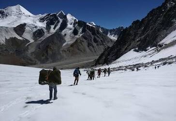
You will be trekking on purely alpine terrain. The trail will be very steep, with up to 60° of incline, loose rocky soil, and permanent glaciers. There will not be a defined trail; rather you will have to find your own path by following cairns and following the tracks made by your support staff. Be prepared for high concentration as you traverse through the glacier moraine. The loose footing can make it physically hard. Take it slow and use a rhythmic pace to continue on your way.
The Bali Col campsite delivers an authentic expedition experience which requires all camping equipment to be utilized. The team sets up tents on both snow and hard-packed glacial ice surfaces. This night represents the coldest point of the trek when temperatures typically reach -10°C or below. The survival operation requires only essential equipment which requires you to stay inside your heavy-duty sleeping bag while your boots and water bottles must remain inside your tent to stop them from freezing.
Trek Distance: 14 Km (10 - 11 hrs)
Altitude Loss: 4,000 ft.
Meals: Breakfast, packed lunch, snacks & dinner
Stay: At Lower Dhamni campsite
The most difficult part of the trek, which brings the highest satisfaction to trekkers, occurs on Summit Day. You will cover 14 km over 10 - 12 hours. The day starts at 3:00 AM with a steep trek to the Bali Pass summit (16,200 ft), followed by a long, technical descent to the Lower Dhamni campsite. You will experience a massive altitude variation, ending the day 5,000 ft lower than the pass.
The ascent to the pass is a 2-3 hour grind over steep snow slopes and narrow ridges. The Pass itself is a razor-sharp ridge where space is limited. The descent becomes difficult because it includes a 60-degree slope that combines soft snow with loose scree. To navigate this terrain, trekkers must execute snow sliding or perform controlled step-kicking while using microspikes. As you descend, the landscape progresses from glacial ice to rocky terrain and finally reaches the Yamunotri valley's forested slopes.
Lower Dhamni functions as a refreshing break for the trekkers. The air here provides two advantages after frozen nights at high altitude because it contains abundant oxygen and has higher temperatures. The campsite occupies space between two forested areas. The return to tent camping makes your life easier because you now have access to springs, which provide water throughout the area, and the survival mode from the previous two days ends with a celebratory atmosphere.
Trek Distance: 8 Km (4 - 5 hrs)
Altitude Loss: 2,600 ft.
Drive Distance: 170 Km (7 - 8 hrs)
Meals: Breakfast & packed lunch
The trek reaches its conclusion through an 8-kilometer trek, which takes between 4 and 5 hours, and proceeds to a 170-kilometer drive, which requires 7 to 8 hours to reach Dehradun. The trail begins at Janki Chatti and leads you through dense vegetation until you reach the sacred shrine of Yamunotri. The group will start their return journey to the city, after which they will reach Dehradun by late evening.
The trek today is a refreshing change from the high-altitude glaciers. The trail leads downward through dense forests which contain Rhododendron and Oak trees. The path starts as a narrow forest trail from Lower Dhamni and eventually joins the wide, paved pilgrim path near Yamunotri. The path becomes easy to trek because the ground has been compacted through frequent use, and your body benefits from higher oxygen levels.
The campsite remains closed for camping activities until tomorrow. At Janki Chatti, you will transition from trekking gear back to travel clothes. The crew will begin the process of loading your luggage into the vehicles. The road to Dehradun leads through the winding pathways of the Yamuna valley, which extends through Barkot. The trekking group will stop at a local dhaba to share one last festive meal before ending their trek.
Includes/Excludes
Includes
- The Bali Pass Trek Package is designed to provide a safe, well-organized, and fully supported high-altitude trekking experience. Trekup India maintains complete transparency in pricing, clearly outlining what is included and excluded. The package covers essential logistics, experienced trek leaders, camping equipment, meals, permits, and safety support, while exclusions include personal expenses, optional services, insurance, and applicable taxes.
- Total Trek Cost: ₹19,450 / person + 5% GST (Mandatory)
- Included in the trek cost:
- All the items that are included in the trek cost customised by Touch Himalayas are mentioned below, with pre-, during, and post-trek support.
- 1 - Pre-Trek Support by Experienced Trek Coordinators: This is a special component of Touch Himalayas, where a personalized trek coordinator is assigned to each trekker and makes your preparation easy before coming on a trek; all your doubts, queries, and myths are clarified, and you are mentally and physically guided to ensure that you come fully fit for your adventure. Every aspect from what to carry, what exercises need to be done, and how to prepare yourself for the trek, all will be guided by Touch Himalayas’s Experienced Trek Coordinators.
- 2 - What is included during the trek: The offered cost covers all major essentials that are mandatory for a successful Adventure, such as accommodation, meals, permits, a team of experts, trek equipment, safety gear, and mules/potters support. We provide you with all the services that are involved in the trek. Below are the specifics.
- Accommodation: 1 night's accommodation in Sankari village with male-to-male & female-to-female preference on quad / multi sharing basis. 6 Nights accommodation in dome-style customised tents of Touch Himalayas on a twin-sharing basis.
- Meals: Your meals with Touch Himalayas start with evening tea & snacks on Day 01 in Sankri and end with breakfast on Day 08 in Lower Dhamni campsite. All meals provided by Touch Himalayas are pure vegetarian and nutritious. We offer you breakfast, lunch, tea, snacks, and dinner. The meals are freshly cooked and not repeated, with delicious sweet dishes each night.
- Food Preferences for Jains: A large percentage of our trekkers belong to the Jain community; therefore, we understand their concerns very well. When we have Jain trekkers on our treks, we will create special, custom-made meals without garlic and onion. We cook these separately from other foods prepared by us, maintaining the same great quality, taste, and hygiene.
- Special Occasions Celebration: Whether it is a birthday, anniversary, group summit, or another event, we enjoy celebrating all these occasions with you by presenting you with a cake that is freshly prepared for your special moment. Touch Himalayas will ensure that every special moment you have here is never forgotten; in fact, it will become an extra special moment.
- Permit: All camping and Trekking Permits from the Forest Department; full assistance in documentation and formalities will be given by the Touch Himalayas team.
- Team of Experts & Professionals:
- Trek Leaders: Qualified and Experienced Trek Leaders to lead your group when on Trek. Touch Himalayas Trek Leaders are AMC, BMC certified and trained for immediate First Aid with a search & rescue Course.
- Assistant Trek Leaders: They are super wise under the Trek Leader's guidance, focusing on the safety, logistics, and trekkers' engagement.
- Local Guides: Experienced local guides familiar with the region & routes. They understand the way of conduct better, especially being locals.
- Support Staff: A team of high altitude including mountain chefs and helpers, to prepare and provide you healthy and freshly cooked meals on your trek.
- Trek Equipment: Touch Himalayas provided high quality of trekking equipments for your adventure, all equipments provided on the trek is 100% customised by Touch Himalayas, any equipments provided is tested on high altitude by our mountain experts and thereafter qualified for use of our trekkers, each fabric and designed are carefully chosen.
- Dome Style Trekking Tents: The sleeping tent we provide is 6/6 ft. in size, giving extra comfort for your sleep at high altitude.
- Sleeping Bags: To provide you with warmth, comfort, and a cosy sleep.
- Sleeping Mattresses: Warm Form mattresses are provided inside your dome tents.
- Kitchen tent: A designated area at the campsite where all the cooking staff prepare all the meals.
- Dining tents: A large common area where all the meals are ready to be served. It is the social space for enjoying meals together.
- Toilet tents: These are private spaces away from the main campsite area to avoid smell and maintain hygiene. We have two separate toilets for males and females.
- Camp Chair/ Table: Portable stools and tables are provided at your campsite.
- Cooking & Service Utensils: All the necessary cooking and serving utensils.
- Safety Gears: Touch Himalayas stands proud itself that all our Treks and adventures operated since 1993 are without any single casualty as we take safety of our trekkers and staff on high priority, following are some of the gears that are included in your trek cost.
- Oxygen Cylinders
- First Aid and Medicine
- Stretchers
- BP Machine to regulate your blood pressure
- Oximeters to regulate your oxygen flow
- Health cards to measure your daily BP and oxygen readings
- Walkie-talkies for Immediate communication
- Micro Spikes
- Gaiters
- Other Safety Equipment such as Helmets, ropes, Ice Axe, Carabiners much more as per technicality of a Trek.
- Porters / Mules Support: Porters / Mules are provided to carry your common trekking gear, rations, trekking equipment, and other supplies.
- 3 - Post-trek Assistance
- This section includes the following -
- Trek Feedback and improvement advice call from your Trek Coordinators.
- How to overcome Trek injuries and settle into normal life.
- Advice and suggestions for the next adventure trek.
- Completion Certificate:
- It is the best way to recognize someone’s adventure journey with a certificate. A well-recognized certificate (IMF, ATOAI & Uttarakhand Tourism Development Board) is provided to the trekker in two ways:
- Reached at Summit: we are giving certificates of summiteer to those trekkers who have completed their trek at the Summit.
- Incomplete Summit: We also provide our certificate for those who have not reached the final summit due to medical reasons, but they are part of the trek.
Excludes
- The Exclusion section for the trek typically outlines all the costs, services, and items that are not included in the trek cost, so there is flexibility and your personal wish for what you can bring. Below mentioned list are exclusively yours.
- Travel to/from Pickup Point: Arrival at the pickup point & from the drop-off point at Prince Chowk is exclusively your call; you can book a bus, train, or flight one day prior & after your trek starts or ends.
- Meals & Accommodation: Any meals or accommodations that are not mentioned in the inclusions are to be managed at your own cost.
- Trek Insurance: This is an optional service to cover unforeseen circumstances during the trek. We highly recommend that you to take insurance, as it contains a very minimal charge per day of ₹38 per person with a coverage of approx. 3 lakh. For more information, check out our website blog: Trek Insurance: Mandatory Coverage for Treks | Touch Himalayas
- Transport Cost: We provide you with the transport facility from Dehradun to Sankri and return from Janki Chatti to Dehradun at the cost of ₹ 2,000 per person & if you come on your own, you have to pay ₹350 from Sankri to Dharkot.
- Personal Services: Other personal services like laundry, phone calls, charging batteries, beverages, bottled / mineral water, or some other services are completely at your own cost.
- Medical Expenses: Any personal medication for your condition is at your own risk. Trekkers are encouraged to bring all their prescribed medicine and any personal first-aid supplies to avoid any uncertainty at the trek.
- Personal Trekking Gear: If you need any extra essentials, you can rent these items like boots, waterproof jackets, gloves, etc. For renting this gear you can contact us at +91 9286542477
- Note: Book your trekking gear 10 days before your trek starts.
- Backpack Offloading: It is a totally optional service. If you have luggage & you want to carry it for the whole trek. you can book before your trek starts. Offload Charges: ₹4,830 per bag for the entire trek if paid online in advance & if you book on the spot, an additional 30% extra cost will be applied.
- Tips for Crew: Tipping is a personal gesture of appreciation for the team’s hard work. If you really like the crew team for their behaviour and kind & welcoming attitude towards the trekkers. So it's up to you how you appreciate them with some cash or a gift. It's exclusively your wish.
Frequently Asked Questions
The Bali Pass Trek is located in Uttarakhand, India, connecting the Har Ki Dun Valley with the Yamunotri region. It offers spectacular views of the Garhwal Himalayas.
Bali Pass reaches an altitude of approximately 4,950 metres (16,240 feet) above sea level, making it a challenging high-altitude Himalayan trek.
The Bali Pass Trek is considered difficult. It involves steep ascents and descents, rocky terrain, snow and ice in some conditions, and high-altitude sections. Previous trekking experience and excellent physical fitness are strongly recommended.
The trek generally takes around 7–9 days, depending on the itinerary, starting point, acclimatisation schedule, and weather conditions.
The total trekking distance is approximately 60–70 kilometres, depending on the route and itinerary selected.
The most popular trekking windows are generally May to June and September to October. Snow conditions, rainfall, and trail accessibility can vary, so check local conditions before departure.
No. Bali Pass is not recommended for beginners because of its high altitude, steep terrain, and demanding mountain sections. Previous experience with high-altitude treks is advisable.
The trek commonly starts from Sankri in the Uttarkashi district, Uttarakhand. The exact starting point and route may vary according to the trekking itinerary.
Yes, travelling with an experienced trekking team is strongly recommended. The high-altitude terrain, changing weather, and technical sections can make independent trekking dangerous.
Yes, trekkers generally stay at designated campsites along the route. Camping arrangements depend on the itinerary, weather, and local regulations.
Trekkers should have strong cardiovascular endurance, leg strength, and the ability to walk for several hours on consecutive days. Regular hiking, stair climbing, running, and strength training can help with preparation.
Snow may be present, particularly around higher-altitude sections and during early-season departures. The amount of snow depends on recent weather and seasonal conditions.
The trek is known for the Har Ki Dun Valley, alpine meadows, remote mountain villages, dramatic Himalayan peaks, high-altitude campsites, and panoramic views from the Bali Pass.
Essential items include sturdy trekking boots, thermal layers, a waterproof jacket and trousers, a warm insulated jacket, gloves, sunglasses, sunscreen, a headlamp, a water bottle, personal medication, and a suitable backpack.
Permit requirements may depend on the route, forest regulations, and current local rules. Check with the relevant authorities or your trekking operator before departure.
Mobile connectivity is limited and unreliable in many remote sections of the trek. Inform your family about your itinerary and be prepared for periods without phone or internet access.
Touch Himalayas can help you plan your Bali Pass adventure with itinerary guidance and trekking support. Contact the team for available dates, package inclusions, accommodation details, and booking information.